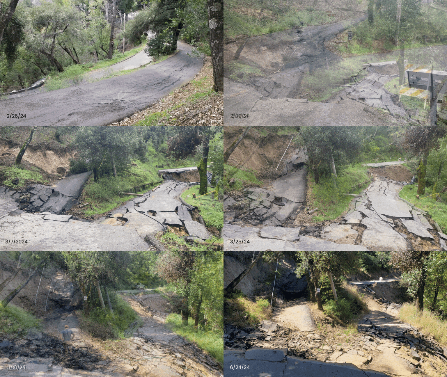
On February 26, 2024, the County of Santa Cruz became aware of land movement on Mountain Charlie Road. Since then, crews have been closely monitoring what has been identified as a deep-seated landslide under Mountain Charlie Road, also affecting an adjacent driveway. The landslide has been sinking on average one foot per week and is currently showing signs of slowing.
Once the road stabilizes, crews will be able to survey the damage, determine repairs needed, and estimate the cost associated with repairs.
Funding Source:
Presently, we are actively working to create a comprehensive finance plan, collaborating with our local, state, and federal partners to explore all available avenues for support.
Mountain Charlie Road
Weekly Land Movement (April 2024-June 2024)
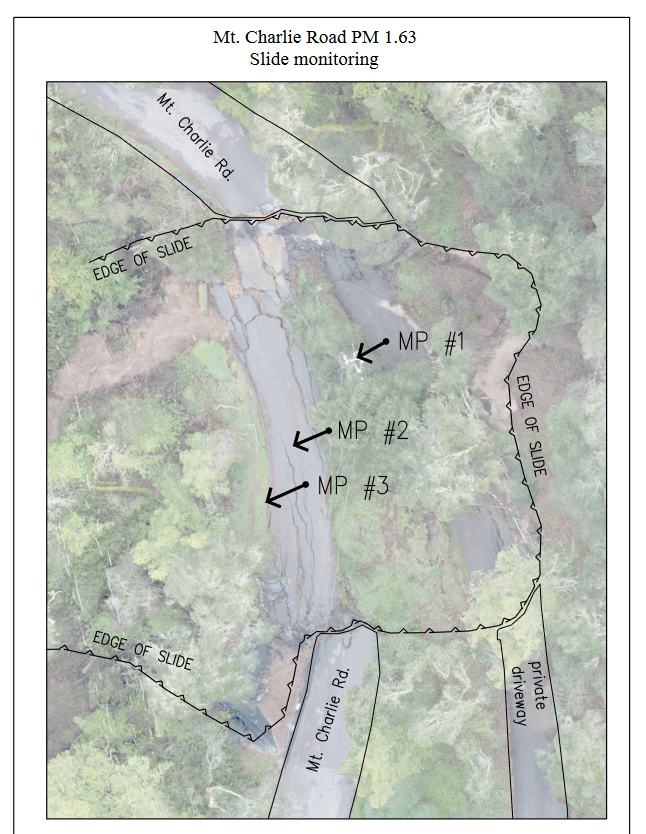
Land movement on Mountain Charlie Road is measured every week using a 3 montoring points. These measurements reflect the weekly total land movement horizontally and veritcally for each point.
Monitoring Point #1
- 4/4/24: 2.37' Horizontal, 1.86' Vertical
- 4/11/24: 0.77' Horizontal, 0.54' Vertical
- 4/19/24: 0.93' Horizontal, 0.64' Vertical
- 4/25/24: 0.13' Horizontal, 0.07' Vertical
- 5/3/24: 0.03' Hortizonal, 0.01' Verical
- 5/10/24: 0.07' Horizontal, 0.02' Vertical
- 6/24/24: 0.07' Horizontal, 0.03' Vertical
|
Monitoring Point #2
- 4/4/24: 2.88' Horizontal, 1.56' Vertical
- 4/11/24: 0.95' Horizontal, 0.46' Vertical
- 4/19/24: 1.09' Horizontal, 0.55' Vertical
- 4/26/24: 0.16' Horizontal, 0.10' Vertical
- 5/3/24: 0.02' Hortizonal, 0.00' Verical
- 5/10/24: 0.04' Horizontal, 0.01' Vertical
- 6/24/24: 0.03' Horizontal, 0.01' Vertical
|
Monitoring Point #3
- 4/4/24: 3.23' Horizontal, 1.56' Vertical
- 4/11/24: 1.04' Horizontal, 0.49' Vertical
- 4/19/24: 1.19' Horizontal, 0.58' Vertical
- 4/26/24: 0.18' Horizontal, 0.06' Vertical
- 5/3/24: 0.02' Hortizonal, 0.00' Verical
- 5/10/24: 0.03' Horizontal, 0.01' Vertical
- 6/24/24: 0.02' Horizontal, 0.01' Vertical
|

(Click to Expand)