The County's award-winning GIS is a powerful resource for residents. This page provides instructions for using some of the basic features of the GIS Web. The numbers within the text below refer to locations on the images.
- Access the GIS Web.
- Read the disclaimer and click "Agree."
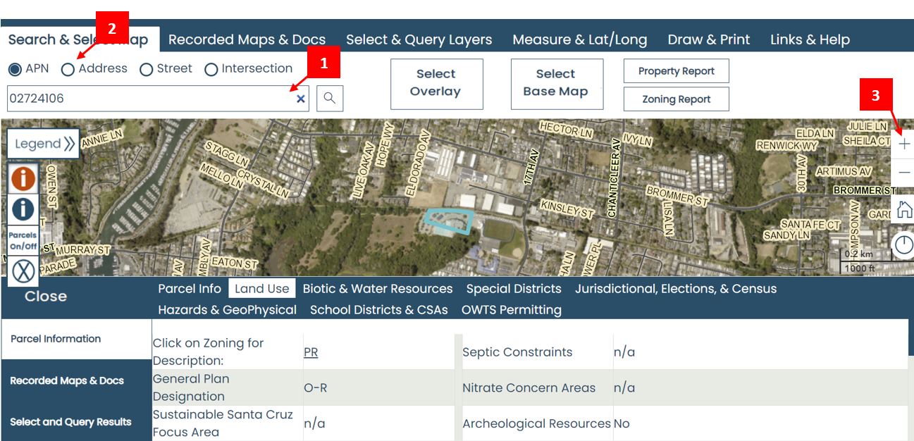
- Use your Assessor's Parcel Number (APN). Enter your APN in the search field (#1) and click the magnifer button.
- Use your address. Click on the "Address" button above the top left search field (#2), enter your address in the search field, and click the magnifier button.
- Use the + and - buttons on the right side (#3) along with clicking and dragging the cursor to find your parcel on the map. Once you've found your parcel, click on it to retrieve information.
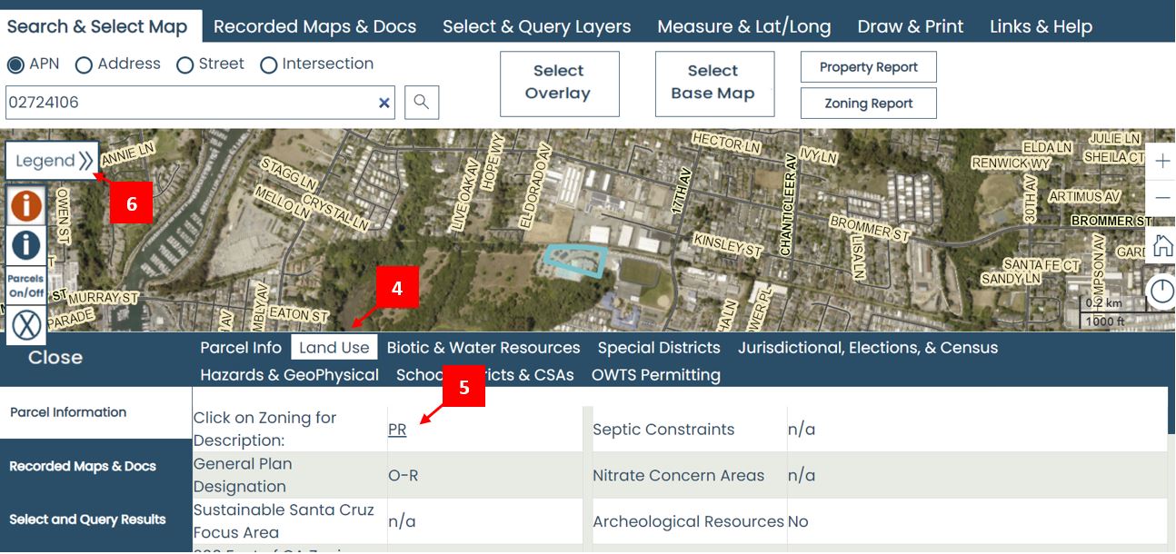
- Once you have found your parcel (see above), you can find its zoning by clicking on the "Land Use" tab (#4) on the table to view the parcel's zoning (#5). The zoning (#5) is a hyperlink that you can click for a description of the zone district.
- To see the zoning for all parcels within the County, click on the Legend (#6) which will reveal all of the layers. Scroll down to "Zoning" and click the arrow to reveal the layers. To see the zoning map, click the box next to "Zoning (text)" and "Zoning Graphic." This will turn on those layers.
For an overview of the zone districts, see the Zone District Summary.
Additional information about zoning is available on the Zoning Information & Clearances webpage.
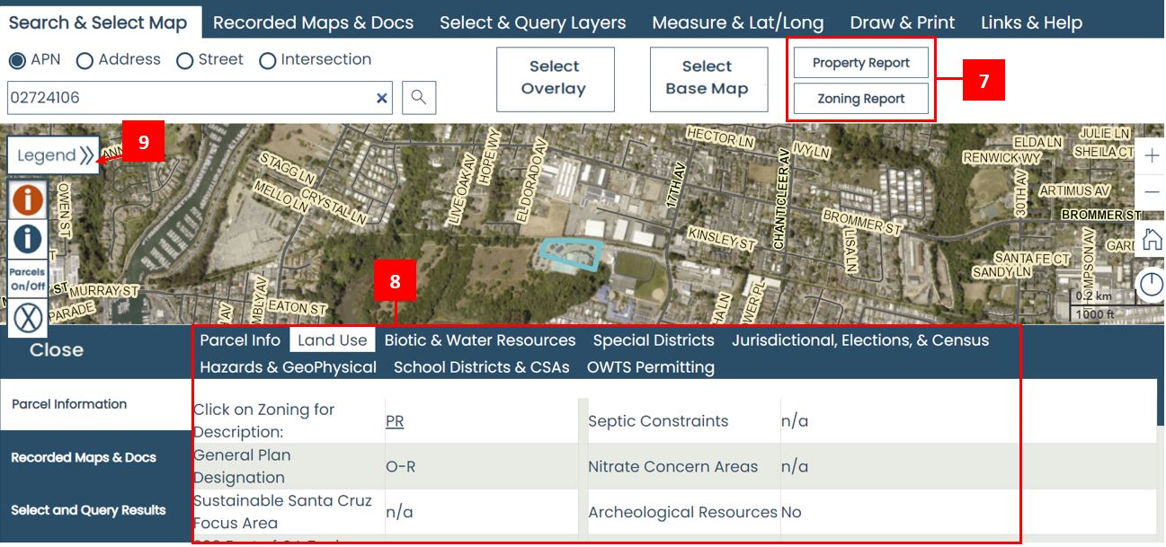
- Run the Property Report.
The Property Report (#7) provides a PDF with land use information as well as information about Biotic & Water Resources, Hazards & Geophysical, Special Districts and more.
- Run the Zoning Report.
The Zoning Report (#7) is a shorter report that focuses on property characteristics that are typically relevant in the land use / permit process.
- Review the table at the bottom of the screen (#8).
This table contains zoning (under the "Land Use" tab) and more information. Click on the tabs (e.g., "Special Districts") to reveal that table's data.
- Explore all the layers.
Click on the "Legend >>" button (#9) on the left side to review all of the available layers of information about your parcel.
If you are ready to learn about the more advanced features of the GIS Web, click on the Links & Help button in the top right corner of the GIS Web.