Welcome to the Santa Cruz County Sea Level Rise Vulnerability Assessment Project
The County of Santa Cruz is conducting a Sea Level Rise Vulnerability Assessment as part of its Local Coastal Program (LCP) specifically focused on addressing coastal hazards. The LCP is a state-mandated plan that guides land use and development along the coast to balance environmental protection, public access, and sustainable growth, and is a community driven effort. We want to hear from you—your input will help shape the outcome of this effort. Community feedback will play a key role in guiding decisions.
Our Project
The Santa Cruz County Sea Level Rise Vulnerability Assessment Project (SLRVA Project) represents a comprehensive planning effort by identifying potential risks and adaptation strategies; the assessment will inform future decisions to safeguard coastal areas and enhance long-term resilience to climate change. This project aims to address challenges such as climate change, sea-level rise, and erosion while ensuring long-term resilience and safeguarding property values, including the natural beauty of our coastline for future generations. The findings will support policies that protect both the environment and public interests as the county prepares for these impacts. The SLRVA project is designed to protect and enhance the unique coastal environment, addressing the challenges of climate change, sea-level rise, and erosion through collaborative, forward-thinking planning.
Recently, an email was shared with many coastal property owners and community members, presenting several inaccurate claims about how the County regulates land use and development on coastal areas.
Key Focus Areas:

We work closely with community members, businesses, and environmental organizations to shape a coastline that benefits everyone.

Our LCP promotes responsible development that aligns with environmental protection, ensuring both property values and natural landscapes are preserved.
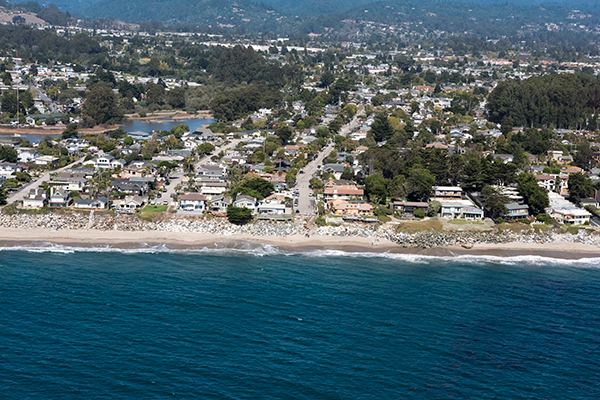
Photo credit: Coastal Records Project

We proactively address coastal risks by planning for sea-level rise and erosion, helping to mitigate future challenges.
Explore the interactive Coastal Zone Map from the California Coastal Commission to visualize the areas in the coastal zone boundary.
Engagement
Community engagement is a key component of this project and is integrated at each step with the development of technical studies. The County will work closely with the community and stakeholders to learn about their concerns, ideas, and long-term vision for the coast, ensuring this study is grounded in lived-experience.
Engagement to-date
- Targeted listening sessions with representatives from business and tourism groups, environmental and community groups, user groups
- General listening session for the public
- Individual one on one interviews with individuals representing land use and design professionals, property owners, neighborhood or community members, community-based organizations, government decision makers, and recreational users
- Pop-ups at Community Events
- Community Working Group member feedback on outreach elements.
Engagement Opportunities:
Community Listening Session Recording